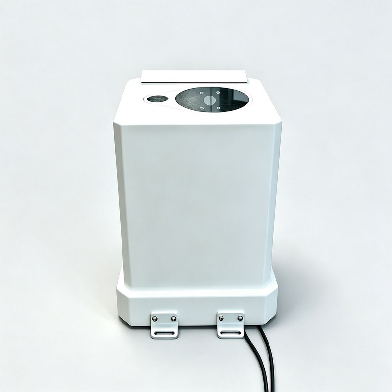
Lidar Ceilometer for Meteorology
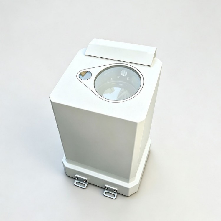
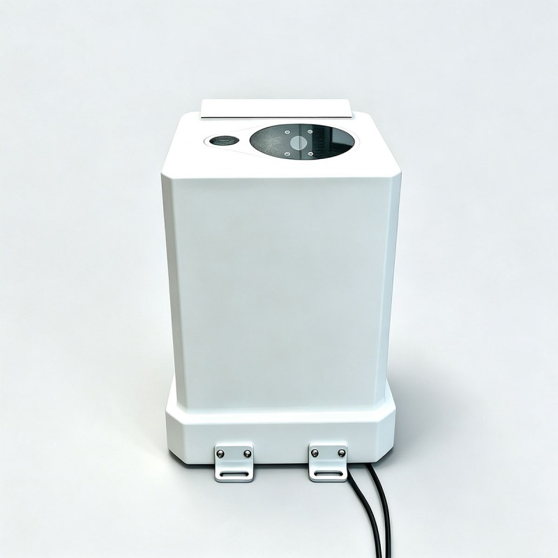
STA-LC56 Laser Ceilometer is a high-performance LiDAR (Light Detection and Ranging) detection device. It employs advanced Mie-scattering LiDAR technology to output high-precision meteorological profile data. Capable of operating around the clock under all weather conditions, it can detect cloud base height, cloud layer thickness, and integrated cloud amount for multilayer clouds, providing reliable data support for meteorological monitoring operations.
Send Inquiry
Product Description
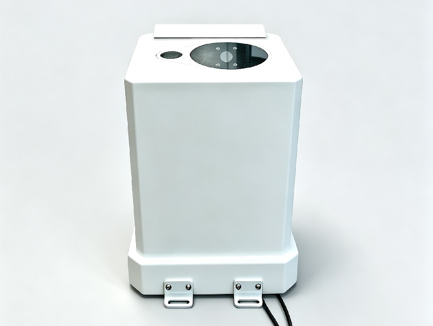
Max Cloud detection range:49210ft
Spatial resolution: 5m
Detectable cloud layers: 5 layers
Spatial resolution: 5m
Detectable cloud layers: 5 layers
Application areas
Meteorological observation and weather forecasting
Aviation weather support (airports, heliports)
Marine weather support (ships, offshore platforms)
Military weather support
Environmental monitoring (atmospheric aerosols, pollutants)
Weather modification (guidance for rain enhancement operations)
Scientific research and education (atmospheric science and remote sensing training)
Measurement of integral cloud cover
Aviation weather support (airports, heliports)
Marine weather support (ships, offshore platforms)
Military weather support
Environmental monitoring (atmospheric aerosols, pollutants)
Weather modification (guidance for rain enhancement operations)
Scientific research and education (atmospheric science and remote sensing training)
Measurement of integral cloud cover
Product Parameters
| Model | STA-LC56 | |
| Laser Wavelength | 1550nm | |
| Receiving Aperture | φ130mm | |
| Emission aperture | φ35mm | |
| Detection performance | ||
| Cloud detection range | 15-15000m(49-49210ft) | |
| Spatial resolution | 5m(16.4ft) | |
| Measurement accuracy | ± 5m(16.4ft) (solid target) | |
| Detectable cloud layers | 5 Layers | |
| Electrical Characteristics | ||
| Power supply | AC220V (1 ± 15%), 50Hz ± 2.5Hz | |
| Power consumption | ≤ 100W | |
| Interface type | RJ45 and RS485 optional | |
| Baud rates | 9600bps, 19200bps, 38400bps, 57600bps, 115200bps can be set | |
| Data update cycle | Continuously adjustable from 20s to 120s | |
| Environmental adaptability | ||
| Working temperature and humidity | Environmental temperature | -45C~50℃ |
| Relative humidity | 5% to 100% | |
| Storage temperature and humidity | Environmental temperature | -55C~60℃ |
| Relative humidity | 5% to 100% | |
| Protection level of the whole machine | IP65 | |
| Physical properties | ||
| Weight | ≤ 20kg | |
| Dimensions (LxWxH) | ≤ 320*330*480mm | |
Note: This product has obtained relevant certification from the meteorological authority. Its performance specifications, environmental adaptability, and measurement accuracy all comply with the requirements of meteorological observation standards. The measurement data are reliable, and the unit operates stably, providing trustworthy monitoring assurance for meteorological observation services.
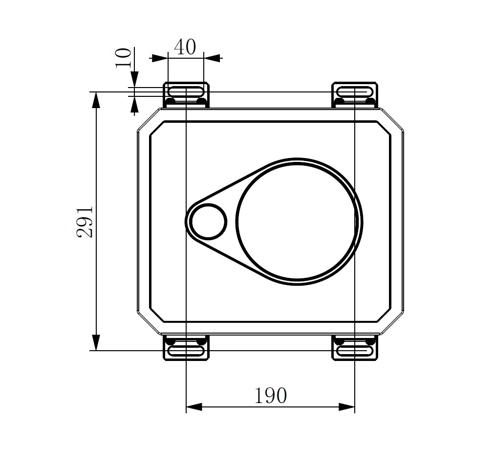
Installation dimension diagram of STA-LC56 laser cloud height meter
Product Overview
The STA-LC56 Laser Ceilometer is a Mie-scattering lidar. It adopts the Mie-scattering effect of atmospheric aerosol particles on laser to detect aerosols such as dust and cloud-fog particles in the lower atmosphere below 15km(49210ft). Compared with other scattering mechanisms, Mie-scattering features a larger scattering cross-section and stronger echo signals. Since most atmospheric aerosol particles are distributed at low altitudes, detection can be performed conveniently. The instrument is deployed for observation of cloud‑base height and integrated cloud amount in airports, ships, mobile survey vehicles, meteorological stations and other scenarios.
Working Principle
Operating on the laser ranging principle, the ceilometer emits periodic laser pulses into the atmosphere. The receiver captures back-scattered echo signals from clouds and the atmosphere. The processor processes and inversely calculates the received signals to obtain atmospheric extinction coefficients at different altitudes, so as to identify cloud layers and compute cloud-base height.
Main Functions
a) It can measure and display cloud base height, cloud layer thickness and atmospheric boundary layer height in real time, and output vertical visibility data under obscured sky conditions.
b) It supports multi-layer cloud detection, identifying and measuring up to 5 cloud layers, and synchronously outputting the cloud base height, cloud thickness and integrated cloud amount of each layer.
c) It is equipped with an automatic self-check function to monitor the operating status and working parameters of core components, ensuring stable equipment operation.
d) It supports parameter configuration via external terminal software and features power-off protection. All configured parameters can be permanently saved without loss after power failure.
e) The output data format fully complies with the ceilometer specifications specified in the Surface Meteorological Observation Data Dictionary, realizing standardized data output and convenient docking with meteorological business systems.
f) Integrated with intelligent automatic control functions including optical lens self-cleaning and equipment self-heating, which adapts to complex outdoor working environments.
g) Built-in data storage supports continuous recording and preservation of historical monitoring data for no less than 3 months, facilitating data review and analysis.
Main Functions
a) It can measure and display cloud base height, cloud layer thickness and atmospheric boundary layer height in real time, and output vertical visibility data under obscured sky conditions.
b) It supports multi-layer cloud detection, identifying and measuring up to 5 cloud layers, and synchronously outputting the cloud base height, cloud thickness and integrated cloud amount of each layer.
c) It is equipped with an automatic self-check function to monitor the operating status and working parameters of core components, ensuring stable equipment operation.
d) It supports parameter configuration via external terminal software and features power-off protection. All configured parameters can be permanently saved without loss after power failure.
e) The output data format fully complies with the ceilometer specifications specified in the Surface Meteorological Observation Data Dictionary, realizing standardized data output and convenient docking with meteorological business systems.
f) Integrated with intelligent automatic control functions including optical lens self-cleaning and equipment self-heating, which adapts to complex outdoor working environments.
g) Built-in data storage supports continuous recording and preservation of historical monitoring data for no less than 3 months, facilitating data review and analysis.
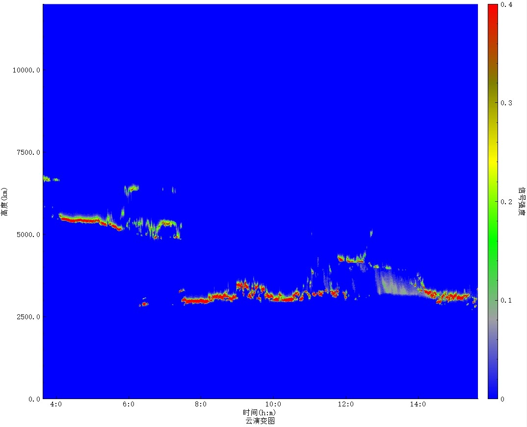
Cloud evolution diagram
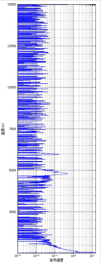
Curve Display
Hot Tags: Lidar Ceilometer for Meteorology, Manufacturers, Suppliers, Factory, China, Made in China, Customized, High Quality
Related Category
Laser Rangefinder Module
Laser
Fiber Optic Gyro
MWIR Camera
Laser Gyroscope
Thermal imaging
Laser Rangefinder Binoculars
Camera
AESA Radar
Electronic Compass
Laser Defense
Wireless video transmission link
Laser Warning Sensor
Laser Ceilometer
Send Inquiry
Please feel free to give your inquiry in the form below. We will reply you in 24 hours.