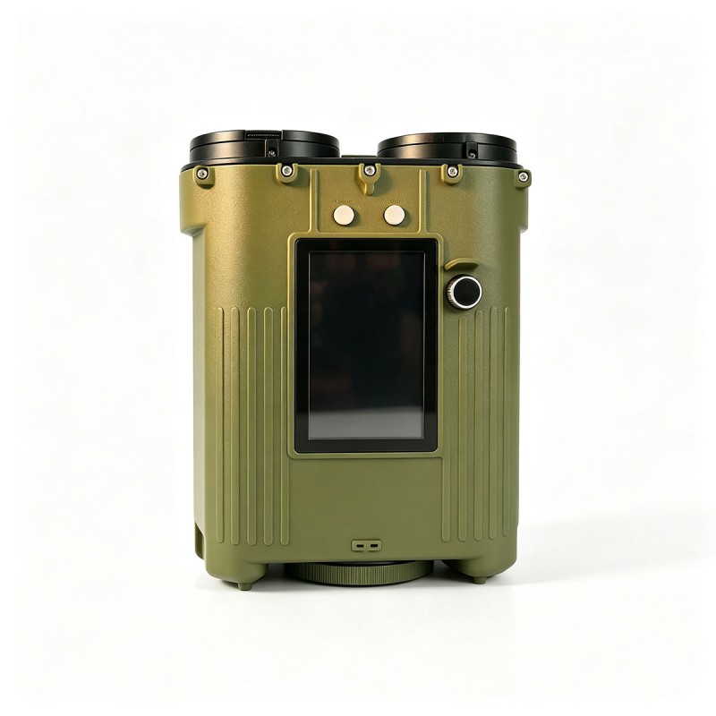
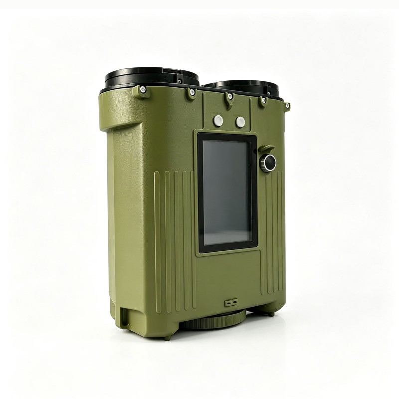
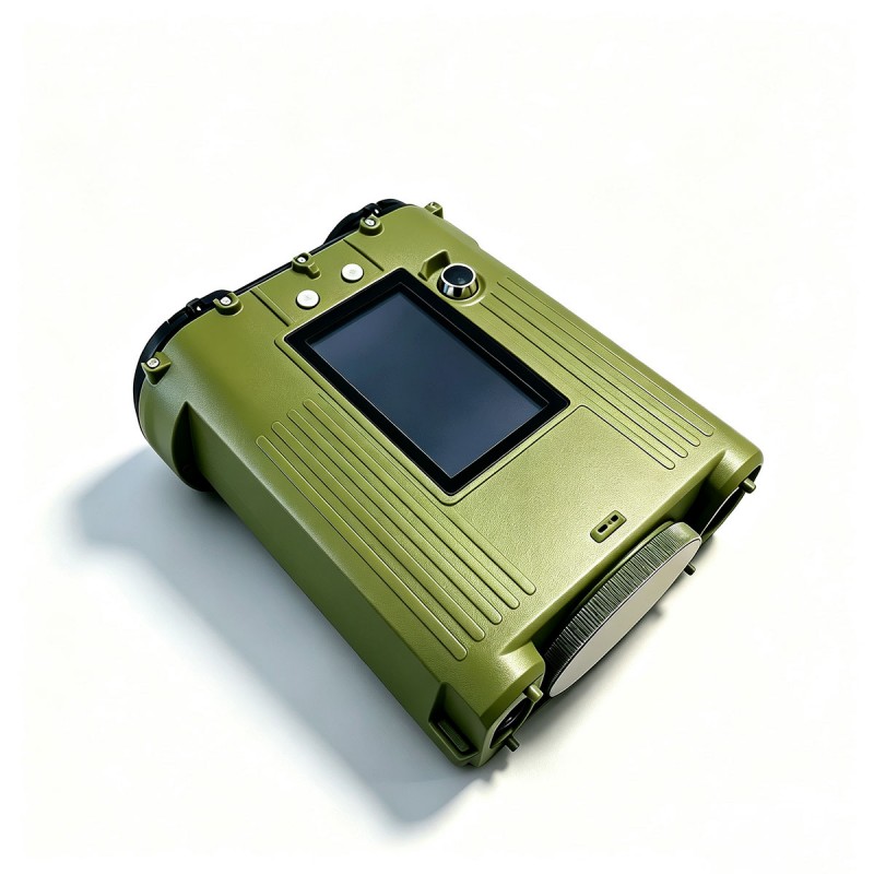
Portable Laser Ceilometer for Meteorology
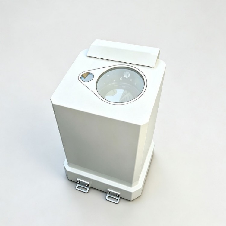
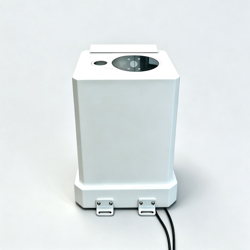
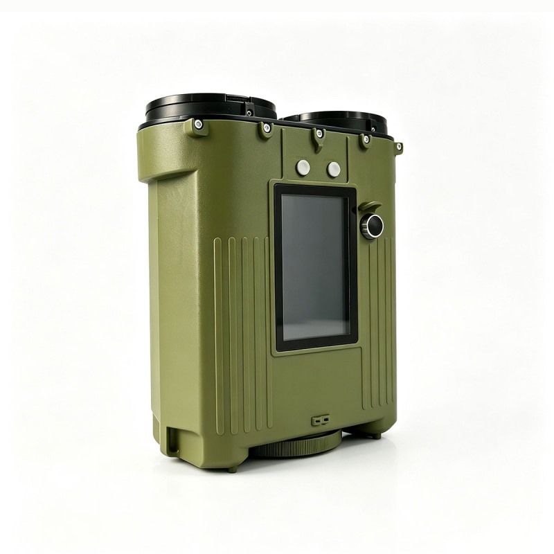
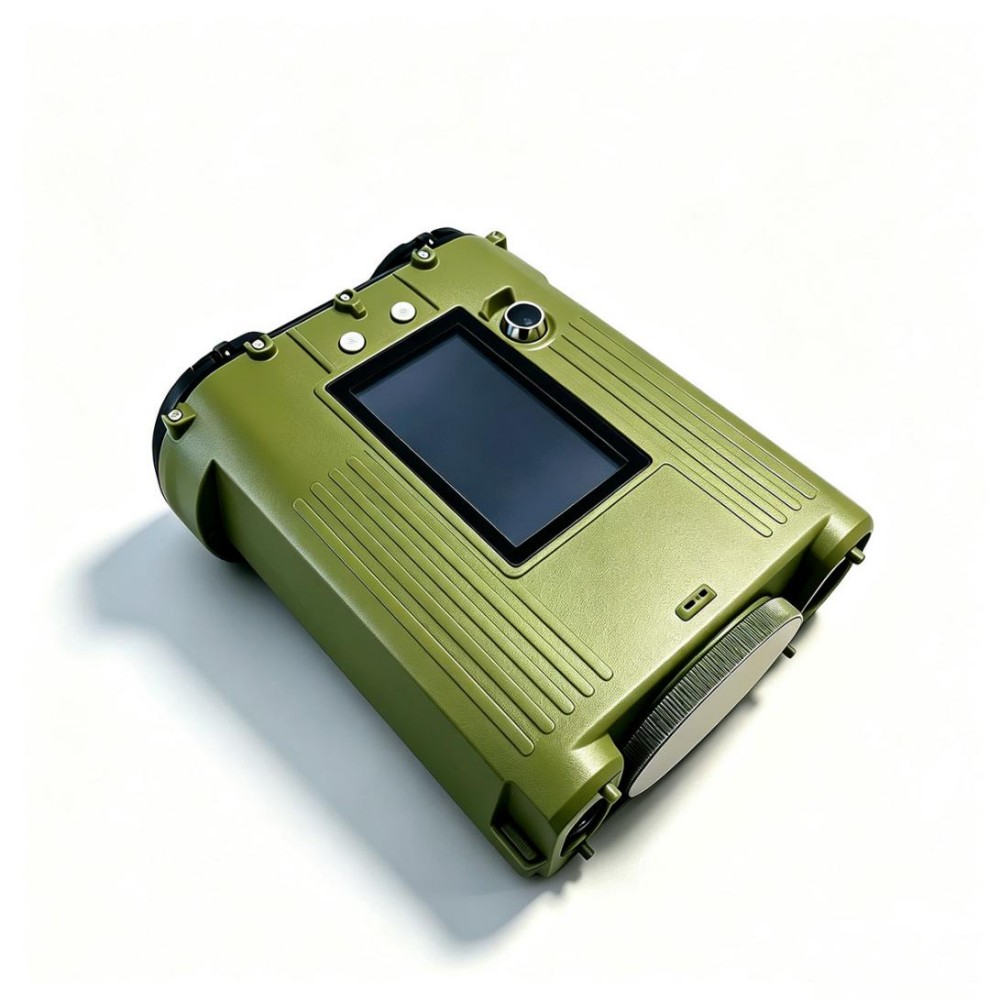
STA-LC57H Handheld Meteorology Laser Ceilometer is an advanced meteorological and environmental monitoring instrument that utilizes LiDAR technology to accurately measure cloud height, thickness, and multi-layer cloud distribution. With a detection range of up to 10,000 m, it can simultaneously detect and output cloud base height information for up to three cloud layers. Featuring a lightweight design, low power consumption, and easy operation, this device is suitable for typical applications such as airports, ships, and training facilities, and operates reliably in a variety of complex environments including inland areas, marine regions, and high-altitude plateaus.
Send Inquiry
Product Description
Max detection distance of clouds: 10000m(32800ft)
Spatial resolution: 5m(16.4ft)
Detectable cloud layers: 3 layers
Spatial resolution: 5m(16.4ft)
Detectable cloud layers: 3 layers
Application areas
Meteorological observation and weather forecasting
Aviation weather support (airports, heliports)
Marine weather support (ships, offshore platforms)
Military weather support
Environmental monitoring (atmospheric aerosols, pollutants)
Weather modification (guidance for rain enhancement operations)
Scientific research and education (atmospheric science and remote sensing training)
Aviation weather support (airports, heliports)
Marine weather support (ships, offshore platforms)
Military weather support
Environmental monitoring (atmospheric aerosols, pollutants)
Weather modification (guidance for rain enhancement operations)
Scientific research and education (atmospheric science and remote sensing training)
Product Parameters
| Model | STA-LC57H |
| Laser Wavelength | 905nm |
| Receiving Aperture | Φ76mm |
| Emission aperture | Φ76mm |
| Detection performance | |
| Cloud detection range | 50-10000m(164-32800ft) |
| Spatial resolution | 5m(16.4ft) |
| Measurement accuracy | ± 5m (16.4ft)solid target |
| Detectable cloud layers | 3 layers |
| Pitch angle | Range 0 °~90 ° |
| Azimuth angle | Range 0 °~360 ° |
| Data output frequency | 10s (single), 60s (continuous) |
| Electrical Characteristics | |
| Battery | Lithium battery 10.8V/5400mAh |
| Power supply | DC19V (power supply+charging) |
| Charging time | ≤ 2.5h |
| Working hours | ≥ 500 times (manual mode) |
| ≥ 6h (automatic continuous mode) | |
| Communication interface | RS485, baud rate: 115200bps |
| Maximum wired transmission distance | ≥ 300m |
| Power consumption | ≤ 7W |
| Environmental adaptability | |
| Working temperature | -40 ℃ ~ 50 ℃ |
| Storage temperature | -45 ℃ ~ 60 ℃ |
| Protection level of the whole machine | IP65, anti salt spray, corrosion-resistant |
| Physical properties | |
| Weight | ≤ 2kg |
| Dimensions (LxWxH) | ≤ 225 * 195 * 115mm |
Note: This product has obtained relevant certification from the meteorological authority. Its performance specifications, environmental adaptability, and measurement accuracy all comply with the requirements of meteorological observation standards. The measurement data are reliable, and the unit operates stably, providing trustworthy monitoring assurance for meteorological observation services.
Appearance and button introduction
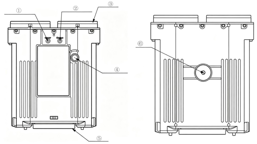
①Power indicator light: The power indicator light lights up when turned on and goes off when turned off.
②Charging indicator light: The power indicator light lights up when the battery is charged or low.
③Lens cover: Used to protect the lens glass and needs to be covered when not measuring.
④Power button: Long press to turn on or off, click to cycle the measurement mode, double-click to switch between continuous or single mode.
⑤Battery compartment cover: When replacing the battery, it is necessary to rotate and remove the battery compartment cover.
⑥Tripod adapter
②Charging indicator light: The power indicator light lights up when the battery is charged or low.
③Lens cover: Used to protect the lens glass and needs to be covered when not measuring.
④Power button: Long press to turn on or off, click to cycle the measurement mode, double-click to switch between continuous or single mode.
⑤Battery compartment cover: When replacing the battery, it is necessary to rotate and remove the battery compartment cover.
⑥Tripod adapter
Feature Introduction
a) Cloud base height measurement – Emits laser pulses toward the zenith and accurately determines the cloud base height by calculating the round‑trip time of the laser signal from emission to return.
b) Multi‑layer cloud identification – Capable of penetrating cloud layers, it can identify and output the structure of up to three cloud layers, while providing the cloud base height for each layer.
c) Observation mode switching – Supports two modes: single measurement for quick acquisition of current cloud height data, and continuous automatic observation for long‑term monitoring of dynamic changes in cloud height.
d) Data recording and transmission – Built‑in storage for saving raw data and measurement results; supports historical data query and export, and communicates via an RS485 interface.
e) Auxiliary aiming – Utilises aiming marks on the body and the live camera view on the LCD screen to assist the user in precisely aligning the measurement direction.
f) Real‑time display – The LCD screen displays real‑time information including current cloud height, battery level, and device operating status.
g) Dual power supply – Equipped with a large‑capacity rechargeable lithium battery for extended field mobile operation; also features an external power input. When external power is connected, the device automatically switches to external supply and charges the battery, enabling uninterrupted operation for fixed‑site long‑term monitoring.
h) Tripod mount – A standard 1/4‑inch threaded socket at the bottom of the unit allows quick attachment to a professional tripod, effectively reducing measurement errors caused by hand tremor and improving stability and data accuracy during prolonged observations.
b) Multi‑layer cloud identification – Capable of penetrating cloud layers, it can identify and output the structure of up to three cloud layers, while providing the cloud base height for each layer.
c) Observation mode switching – Supports two modes: single measurement for quick acquisition of current cloud height data, and continuous automatic observation for long‑term monitoring of dynamic changes in cloud height.
d) Data recording and transmission – Built‑in storage for saving raw data and measurement results; supports historical data query and export, and communicates via an RS485 interface.
e) Auxiliary aiming – Utilises aiming marks on the body and the live camera view on the LCD screen to assist the user in precisely aligning the measurement direction.
f) Real‑time display – The LCD screen displays real‑time information including current cloud height, battery level, and device operating status.
g) Dual power supply – Equipped with a large‑capacity rechargeable lithium battery for extended field mobile operation; also features an external power input. When external power is connected, the device automatically switches to external supply and charges the battery, enabling uninterrupted operation for fixed‑site long‑term monitoring.
h) Tripod mount – A standard 1/4‑inch threaded socket at the bottom of the unit allows quick attachment to a professional tripod, effectively reducing measurement errors caused by hand tremor and improving stability and data accuracy during prolonged observations.
Operation Introduction
Tripod adapter hole: When using continuous measurement mode, the cloud height measuring instrument can be installed on the tripod through the tripod adapter hole for measurement.
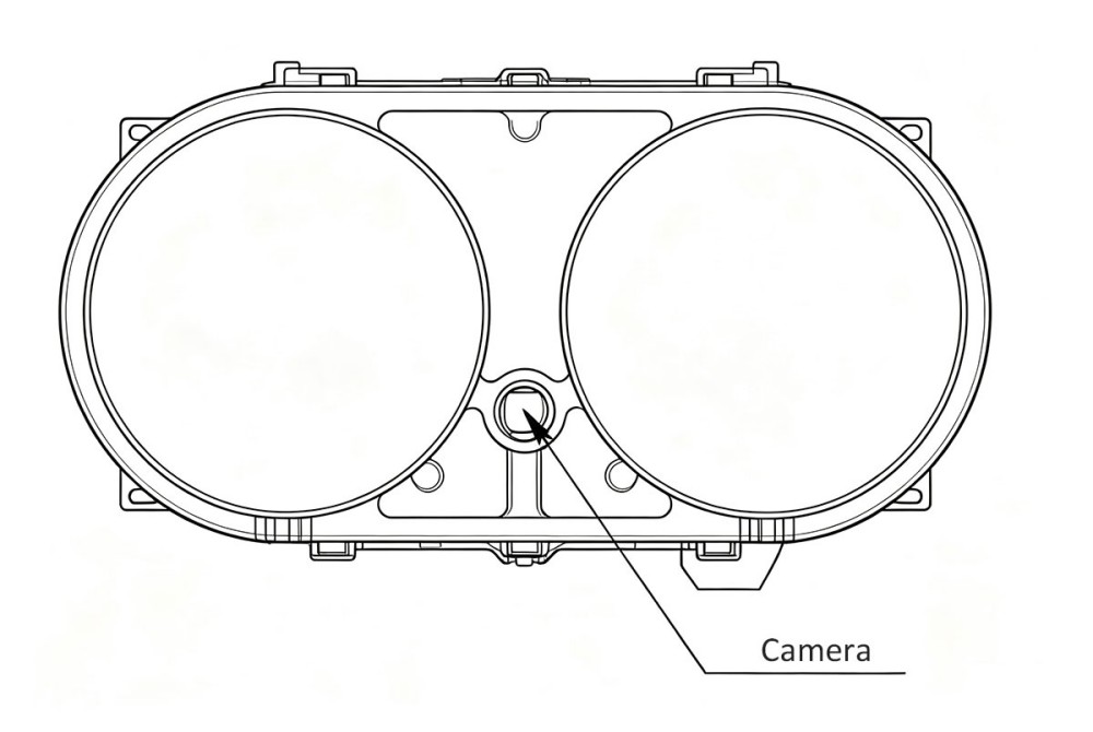
Front view
Camera: Used to assist in aiming and positioning, the camera image is displayed on the LCD screen.
Camera: Used to assist in aiming and positioning, the camera image is displayed on the LCD screen.
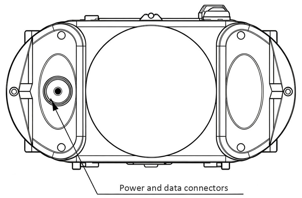
Rear view
Connector:Integrates charging and data transmission functions. When charging, connect the aviation plug to the power adapter; for data transmission, connect to the communication cable.
Connector:Integrates charging and data transmission functions. When charging, connect the aviation plug to the power adapter; for data transmission, connect to the communication cable.
Hot Tags: Portable Laser Ceilometer for Meteorology, Manufacturers, Suppliers, Factory, China, Made in China, Customized, High Quality
Related Category
Laser Rangefinder Module
Laser
Fiber Optic Gyro
MWIR Camera
Laser Gyroscope
Thermal imaging
Laser Rangefinder Binoculars
Camera
AESA Radar
Electronic Compass
Laser Defense
Wireless video transmission link
Laser Warning Sensor
Laser Ceilometer
Send Inquiry
Please feel free to give your inquiry in the form below. We will reply you in 24 hours.